Snow, snow and more snow. That’s the weather forecast for the next week, much to the disappointment of Laramie’s inhabitants. While we are ready for the warm spring weather to return, we might be thankful for the moisture this summer, especially if last summer’s dry conditions return. The new snow has helped bring most water basins in the state up to between 80 and90% of average, but the question remains, will there be enough water? This is the problem WyCEHG is seeking to answer, not just for this year, but for years to come.
WyCEHG is the Wyoming Center for Environmental Hydrology and
Geophysics. It was established in July 2012 through a Track 1 National Science
Foundation EPSCoR grant. The goal of WyCEHG is to understand the complexities
of Wyoming’s water systems using a multi-disciplinary approach. This center
brings together experts from hydrology, geophysics, ecology, ecosystem science,
zoology, and engineering to study and model water systems at both the surface
and subsurface level. To do this, WyCEHG has set up the Surface and Subsurface
Hydrology Lab (SSHL), run by Elizabeth Traver, and the Facility for Imaging the
Near and Sub-Surface Environment (FINSE), run by Dr. Brad Carr. Earlier in the
year, Traver talked to us about SSHL. Today, Dr. Carr explains the role that
FINSE plays in WyCEHG.
“FINSE is the repository of the geophysical equipment as
well as the expertise and training arm,” Dr. Carr says. “So, if any of the
WyCEHG or other researchers on campus want to do geophysical work on any of
their sites, basically we’ll make sure they have the equipment and they know
how to use it.”
While SSHL helps provide researchers with equipment for
surface work, FINSE provides the equipment for the sub-surface. Some of the
equipment for FINSE is already in use, but the acquisition phase is not over
yet.
“We’re still in the process of getting more equipment,” says
Dr. Carr. “There is a certain set of geophysical tools that people apply in the
near surface, mainly seismic, resistivity, radar, electro-magnetic and
magnetic. Right now we’ve accumulated most of tho
se tools, but we’re still
ordering some.”
When studying the shallow sub-surface, there are two general
levels: the very shallow, which is up to 30 feet in depth, and the more traditional
“near-surface”, with is usually defined as between 30 and 10,000 feet in depth.
Each of the tools is ideal for certain depths and for certain measurements. For
instance, radar works best at very shallow depths, where it yields high detail
images, while seismology and resistivity work better at deeper levels, as they
are broad-scale tools.
All of these tools work in different ways, but they all
yield images which describe the subsurface. Seismology, for instance, uses
sound to make its measurements.
“In the near surface for seismology, we tend to use
refraction seismology, where somebody hits the ground with a hammer and we
measure the seismic velocity distribution of materials in the subsurface,” Dr.
Carr explains. “That can tell you how strong the subsurface is, how
consolidated it is (whether it’s rock or soil), and sometimes it can be used to
tell where parts of the ground are more saturated.”
When studying ground water, however, resistivity tools tend
to provide more direct in-situ detection.
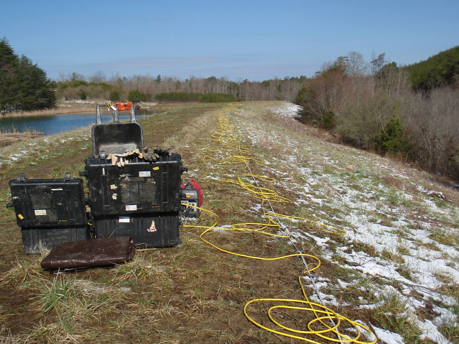 |
| Some of the resistivity equipment used by WyCEHG. |
“With resistivity, we’re mapping at how easy or hard it is
for electric current to flow in the materials below us.” Dr. Carr says.
Ground Penetrating Radar (GPR) is an electromagnetic method
that gives us very detailed images of the sub-surface, ice or snow pack
thickness.
GPR yields high detail images in the upper sub-surface. These
images are ideal for understanding what the sub-surface looks like at that
exact location, whereas resistivity and seismology are provide less detailed
information over a greater area. All of these instruments are useful for the
main levels of the subsurface, but WyCEHG is also going to look a little
deeper. To do this, FINSE will purchase a surface Nuclear Magnetic Resonance
(NMR) system.
“Really, what NMR is look for at is deeper (greater than
1000 feet) aquifer studies,” Dr. Carr says.
NMR is a useful tool for mapping regional watershed, which WyCEHG will
be doing throughout the next few years.
Part of keeping people interested in the center, is
introducing them to the tools. Already, FINSE equipment is being used in UW
classrooms, and this summer, it will be used extensively by researchers in the
fields and during WyCEHG’s two summer camps. This way, people from a variety of
backgrounds and disciplines are studying, understanding, and predicting the
amount of water in Wyoming for the future. And, water, especially from snow, is
everything in our high and dry environment.
By Kali S. McCrackin
Photo courtesy of Dr. Brad Carr
Thanks for sharing such a useful blog.
ReplyDeleteseismic sensor supplier
geophysical vibrator